Information and links may be outdated.
On Minimalistic Maps: Mapping Population Density in the Philippines
Minimalistic maps
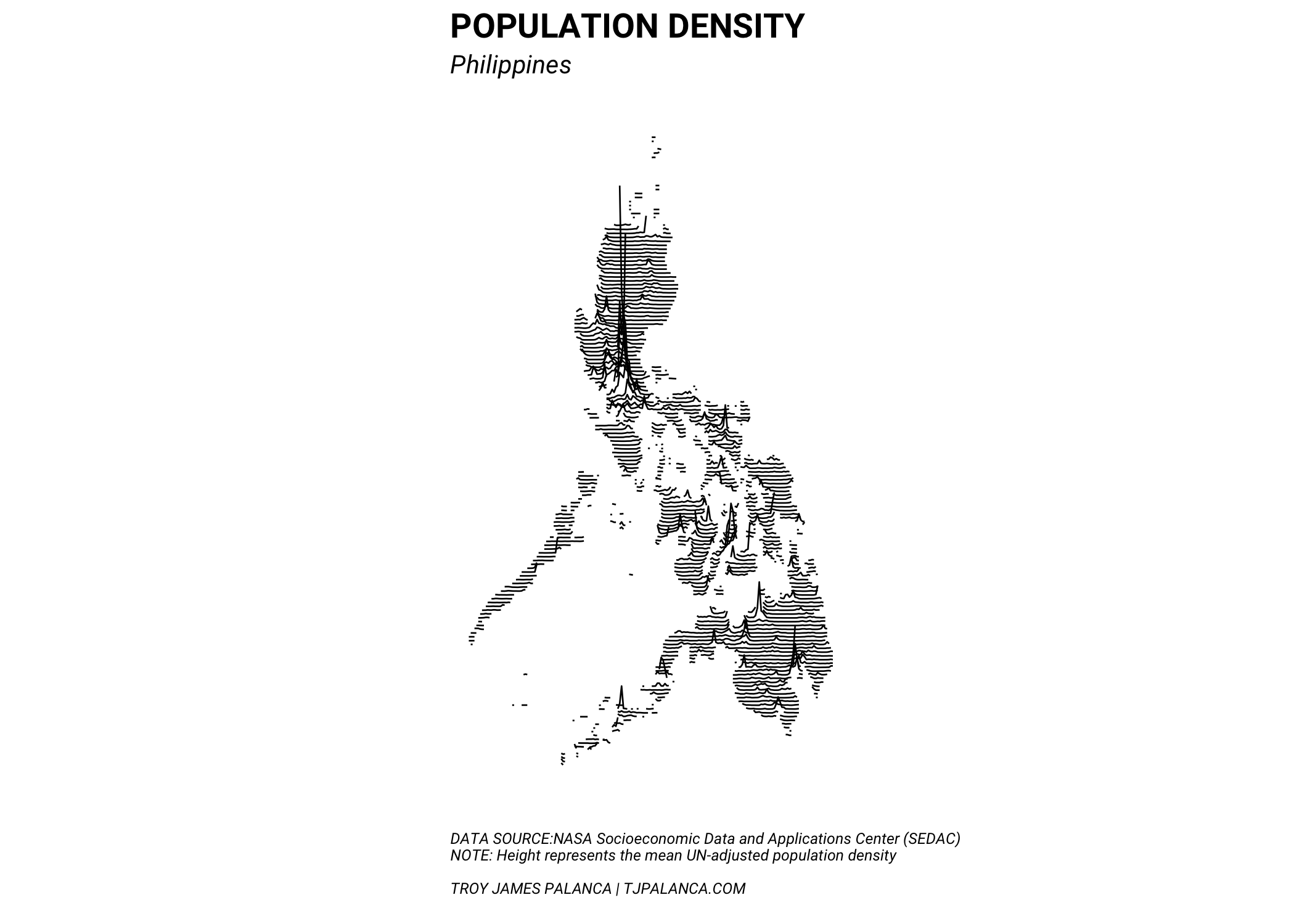
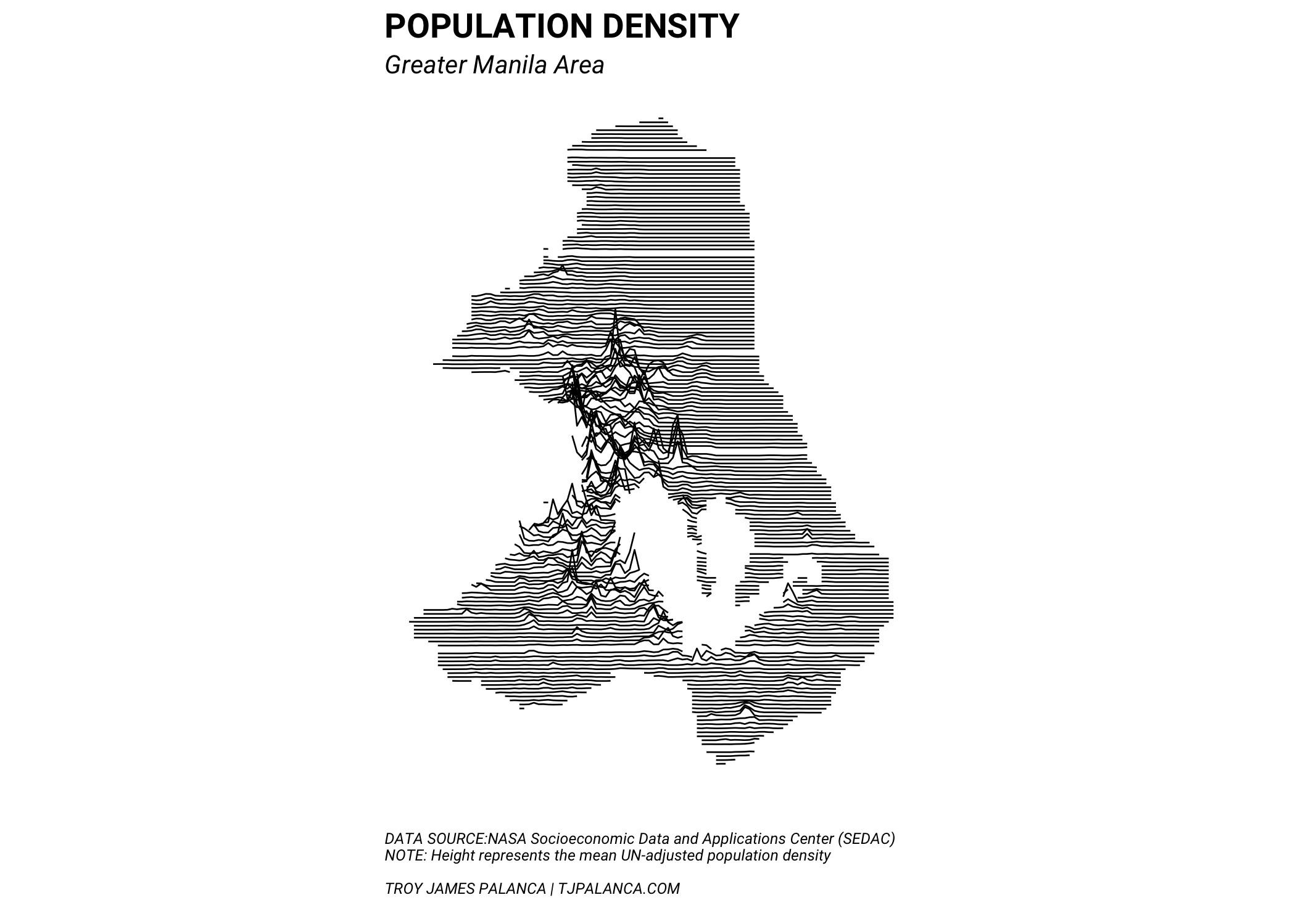
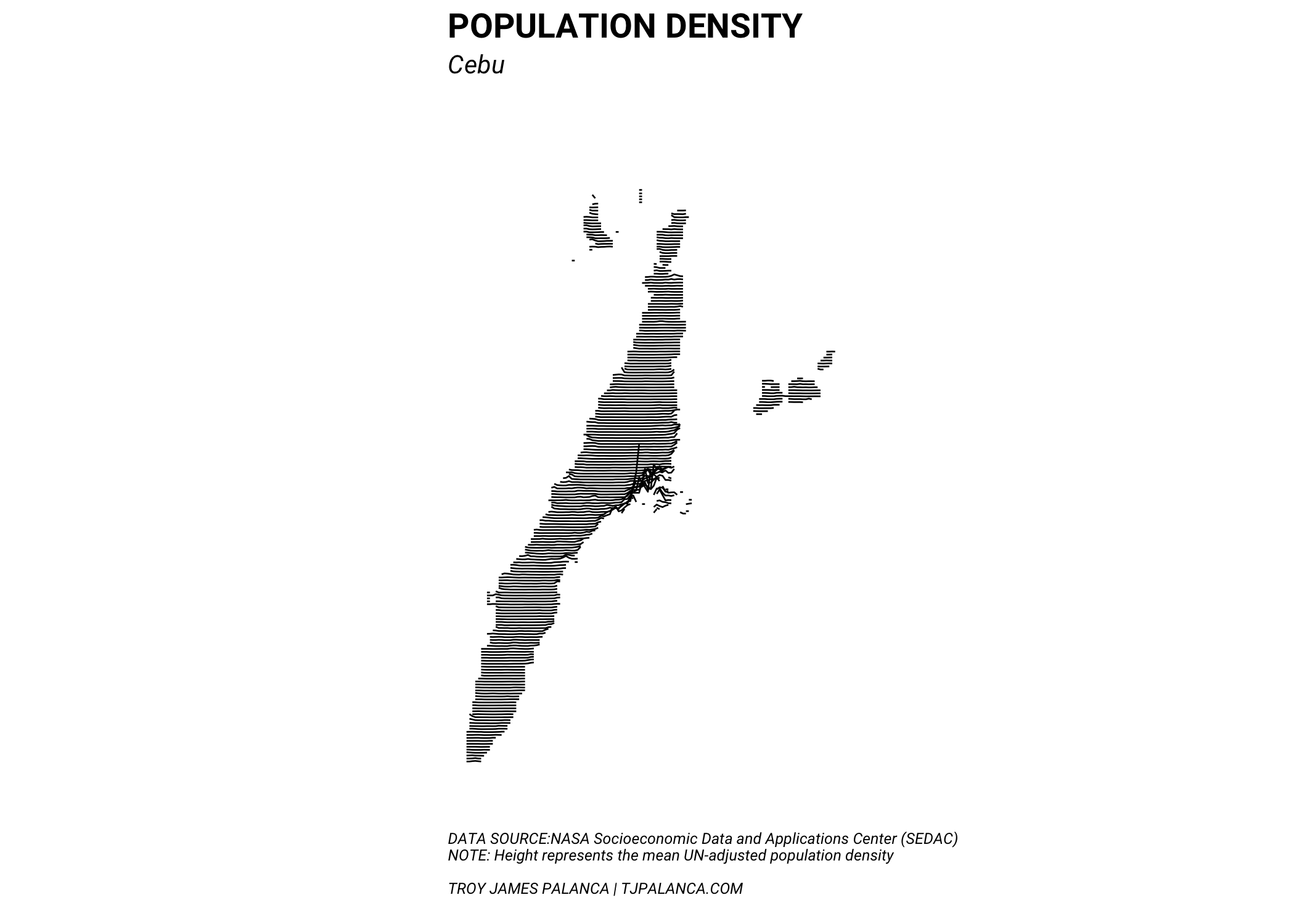
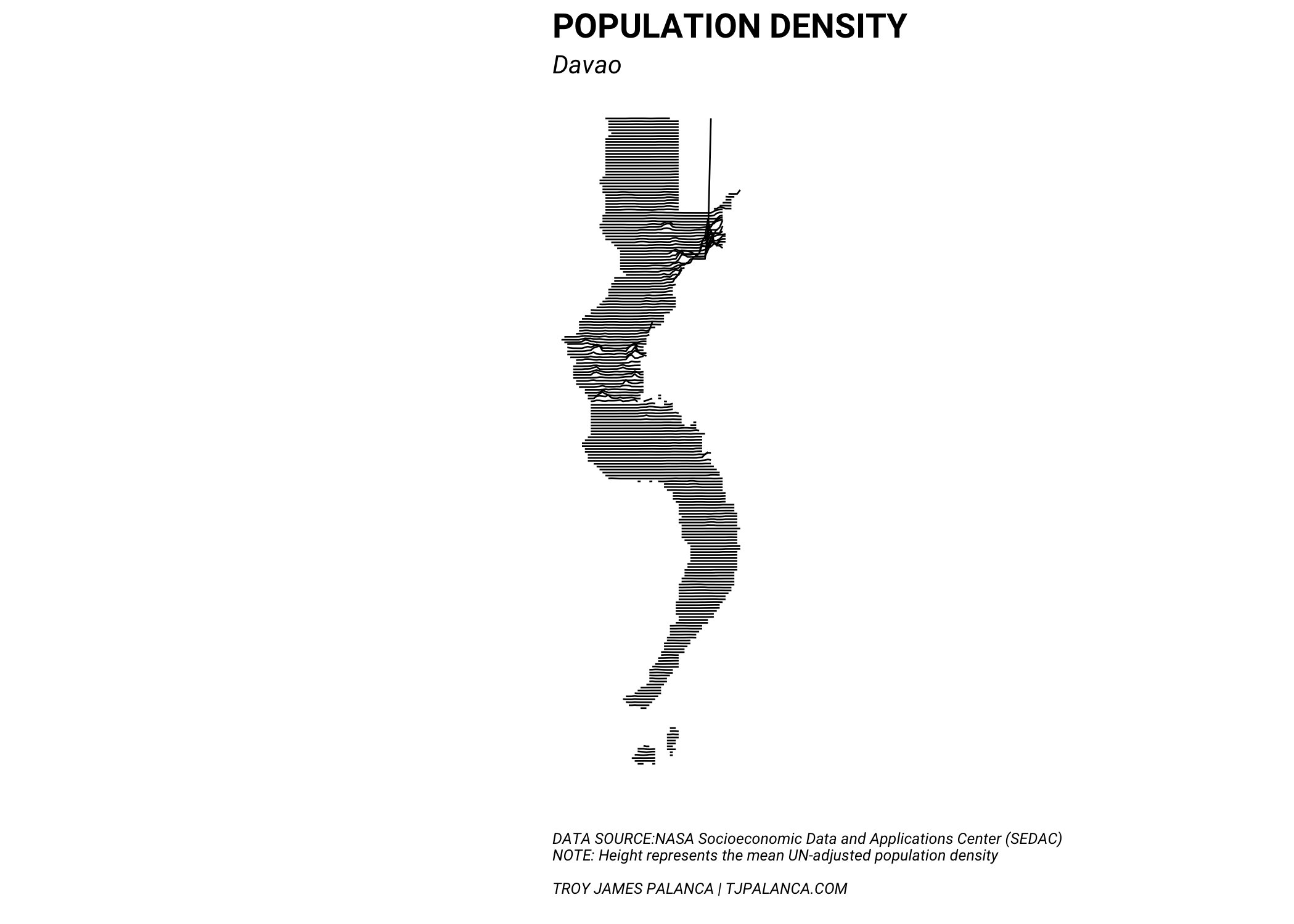
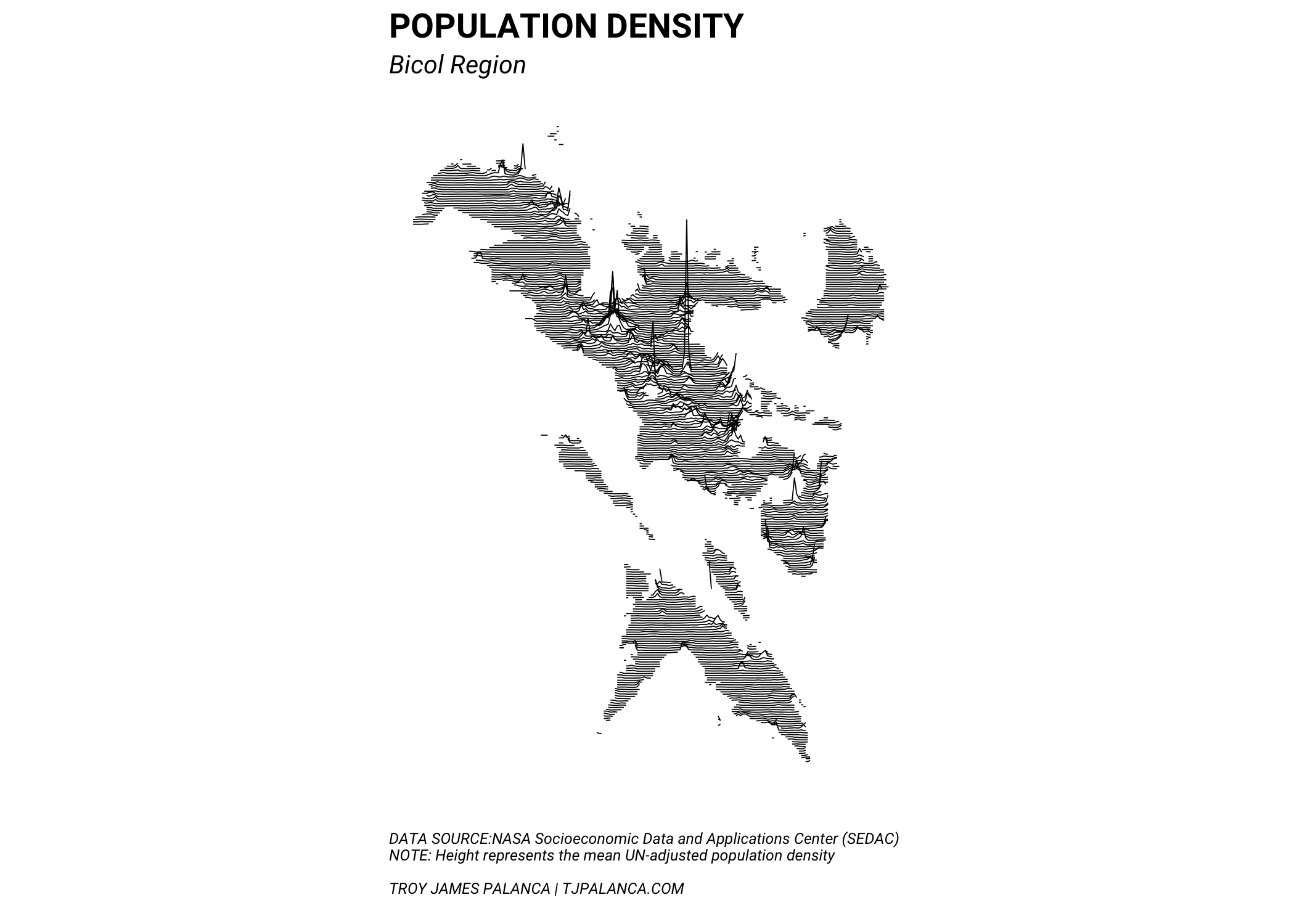
Taking the idea from the Population Lines Print by Spatial.ly / Dr James Cheshire, we plot local population density maps for the Philippines in the same style. The data is taken from the NASA Socioeconomic Data and Applications Center (SEDAC).
Philippine population density maps
Fortunately, the process was relatively straightforward and it was not difficult to produce the same cool faux-3D population peak effect with a bit of data wrangling and good old ggplot2. Here are some I’ve produced for key Philippine metropolitan areas and my home region Bicol.
Reproducibility
Here are the notebooks containing the code, results, and commentary behind the post. You may download the resulting code and run it yourself, provided:
- You have to download the population density maps on your own access rights, and
- You agree that this is provided as-is and with no warranty.
You may also view the GitHub Repository here for the complete code and analysis that went into this post.
2017/05/on-minimalistic-maps.html
posts/2017-05-01-on-minimalistic-maps
content/blog/2017-05-01-on-minimalistic-maps/on-minimalistic-maps.html
articles/on-minimalistic-maps